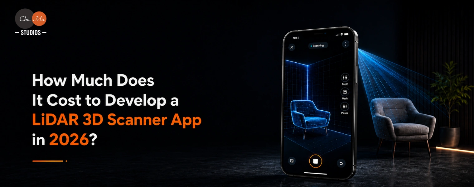
How Much Does It Cost to Develop a LiDAR 3D Scanner App in 2026?
Key Takeaways
- LiDAR app costs depend heavily on scope: Hardware requirements, platform coverage, 3D processing complexity, cloud infrastructure, export formats, and advanced editing features are the biggest cost drivers.
- iOS offers a more predictable development path: Apple’s standardized LiDAR hardware and ARKit APIs make iOS-only development faster and more cost-efficient than supporting the fragmented Android ecosystem.
- 3D processing is the biggest technical cost center: Point-cloud capture, mesh generation, texture mapping, optimization, and cloud-based reconstruction require specialized AR and computational-geometry expertise.
- Feature-rich cross-platform apps require significantly more investment: Supporting Android, cloud processing, multiple export formats, editing tools, accounts, and sharing can push development timelines to 6–9 months.
- Hardware testing is critical to scan quality: Lighting, surface materials, device differences, and the absence of LiDAR on many Android devices make rigorous real-device QA essential for a production-ready scanning experience.
Introduction
LiDAR used to be on rooftops of self-driving cars, not in your pocket. That changed when Apple added a LiDAR Scanner to the iPhone 12 Pro. It’s been popular ever since, appearing in real estate, construction, e-commerce and even fitness applications that measure your living room before you buy a couch. An app founder or product manager scoping out a LiDAR scanner 3D app rarely asks the question “can we build this”, but rather “what will it actually cost”. The honest answer depends on your hardware needs, what platforms you offer, how much processing is done on device vs in the cloud, and how far you want to go with features like measurement tools and mesh export. In this guide, we’ll cover what impacts the cost, the iOS vs Android divide, and realistic budget ranges for 2026.
What Is a LiDAR 3D Scanner App?
LiDAR (Light Detection and Ranging) is a technology that emits pulses of infrared light at a surface and measures the time it takes for the light to return. That measurement of time-of-flight is translated into distance, and thousands of such measurements each second combine to form a depth map of the environment. Apple’s own engineering team has cited this very approach as the foundation of the LiDAR Scanner on iPad Pro and iPhone Pro models, which supplies ARKit with a live topological map. Here’s how an app for scanning LiDAR works, and how it differs from other methods of 3D capture:
- The three-stage pipeline: A LiDAR scanner 3D app takes raw depth data through capture, processing, and export. Capture depth frames as the user moves the device around an object or room. Processing ties the frames together into a point cloud, which is then turned into a triangulated mesh and colored or textured. You can export the result to common file formats (OBJ, STL or USDZ) that can be used in CAD tools, e-commerce platforms and augmented reality viewers.
- Lidar vs photogrammetry: Photogrammetry creates 3D geometry only from a sequence of overlapping images and no depth sensor. It works with any phone camera but it is slower and more sensitive to lighting. What is the iPhone LiDAR technology? The 3D scanner app iPhone LiDAR measures depth directly and provides results in near real-time even in poorly lit rooms.
The hardware environment is asymmetric and this is where LiDAR app budgets differ wildly. Since the iPhone 12 Pro, LiDAR has been a feature of all iPhone Pro and later iPad Pro models, allowing developers for native iOS app development on a well-documented and reliable sensor. Apple’s frameworks expose scene depth, mesh reconstruction and object scanning as first-class APIs, significantly reducing development time for teams targeting iPhone and iPad exclusively.
1. The Android Challenge: ToF Sensors and ARCore Depth API
The ARCore Depth API and ToF sensors have a challenge in that Android doesn’t have a standard LiDAR sensor. Some flagship devices are equipped with time-of-flight (ToF) sensors, but coverage is patchy across makers and generations. Google’s answer is ARCore Depth API, which uses regular camera frames, not a special sensor, to calculate depth from motion, and is only available on an approved subset of devices, Google’s ARCore team says. This means that an Android version of the same software must either use device-specific fallback logic or accept a lower scan fidelity on non-ToF devices. Some teams get around this by using Flutter app development for the non-scanning parts of the app (account management, galleries, sharing) and keeping the scanning module native to each platform, a balance between shared code and sensor-specific performance.
2. Budget Impact of the Platform Split
This separation is the most important determinant of scope and cost. The release of an MVP for iOS only will be faster and cheaper because the hardware and SDK are the same. Supporting Android properly means paying for device testing across multiple ToF-equipped models and designing smooth degradation for handsets that don’t have a depth sensor at all. It also means a dedicated Android app development track that’s not simply a port of the iOS codebase.
Build a High-Performance LiDAR 3D Scanner App for iOS and Android
Core Features of a LiDAR Scanner App
Most production lidar scanner 3d apps share a common feature set, even if the polish varies.
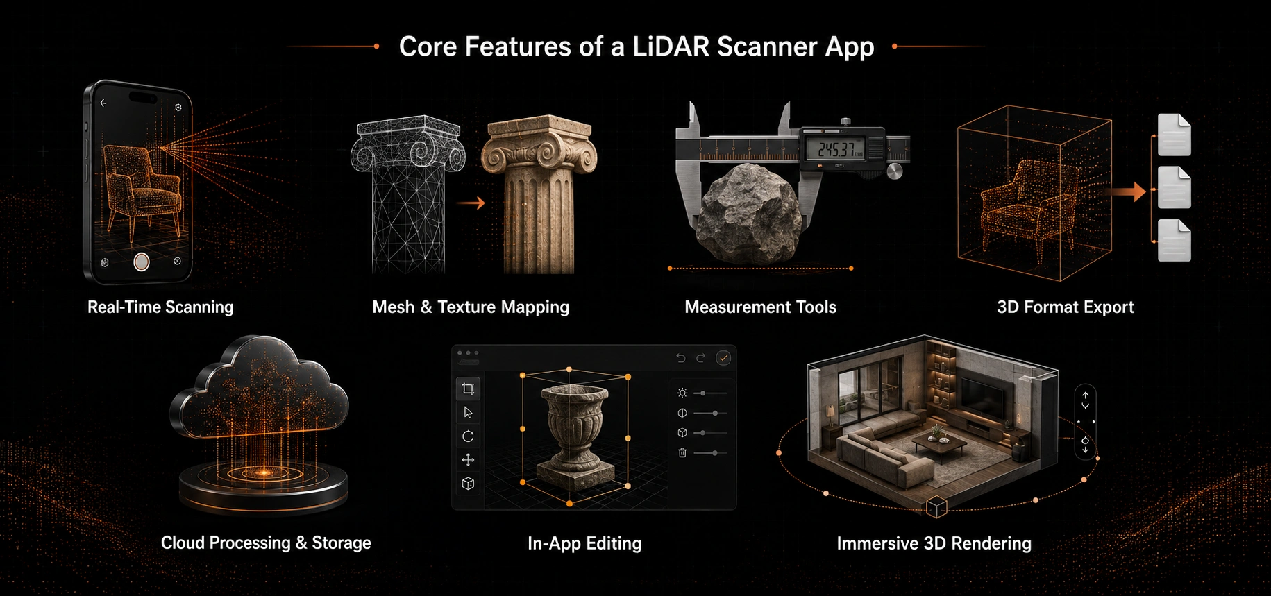
Here are the seven features that define a production-grade scanning app:
- Real-time scanning with live point cloud capture: The scanning is real-time, the point cloud is captured live, so the user can see the geometry being built up as they move the device. It’s more dynamic than batch.
- Mesh generation and texture mapping: Transforms the raw point cloud into a clean colored 3D surface. This is often the most computationally expensive part of the pipeline.
- Measurement tools: Measure distance, area and volume straight on the scanned mesh. A popular differentiator for real estate and construction use cases is bespoke geometry logic, which is often added on top of the AR app development framework that the app is built on.
- Export to standard 3D formats: OBJ, STL, and USDZ are non-negotiable for any app targeting professional or CAD-adjacent workflows, since that is how scans move into downstream tools. A technical survey of point-cloud-to-mesh methods reveals that LiDAR and depth sensors produce denser spatial data than photogrammetry-based techniques.
- Cloud processing and storage: For larger reconstruction works which cannot be done on-device and safe storage of user scans.
- In-app editing tools: Users have access to in-app editing tools to trim or annotate scans before sharing or exporting.
- Immersive 3D rendering: If your team is building a viewer or product configurator using scan data, Unity development is a popular way to render the final 3D asset smoothly across multiple platforms. Apps that use real scans and aim at synthetic settings can take advantage of a specific 3D environment design to place a captured object convincingly into a realistic situation. If the scan requires additional nearby assets, 3D prop modeling provides the context without the need to rescan every object.
Cost Breakdown: What Drives Development Cost
A LiDAR scanning app’s budget is split across many workstreams: UI/UX design, frontend and camera/AR integration, backend infrastructure for storage and processing, the 3D processing pipeline itself, cloud services and testing. The 3D processing layer, point cloud cleanup, mesh generation, and texture baking, is typically the most specialized and thus most costly line item, as it requires developers with expertise in both AR frameworks and computational geometry.
1. Illustrative Cost Ranges and Timeline
These are ballpark figures to give you an idea of the range, a firm quote will depend on your feature list, target device and team rates. Here’s how the budget and timeline break down:
- iOS-only MVP: Low to mid five figures to low six figures. iOS only. Includes iOS-only capture, basic mesh output and basic measurement tools. Timeframe: 3-5 months.
- Feature-rich cross-platform app: Considerably higher range. Cross-platform support, cloud processing, in-app editing, multiple export formats, and account/sharing infrastructure. This tier corresponds to the bands connected with complex, integration-heavy apps as identified in GoodFirms’ more comprehensive mobile app cost analysis. Timeline: 6 to 9 months.
- Key cost drivers: Major costs are in the complexity of the 3D processing pipeline (on-device vs cloud, mesh density, real-time vs batch), the number of export formats supported, and the amount of back-end infrastructure needed for storage and sharing.
2. Why QA and Partner Selection Matter for Accurate Estimates
Rigorous quality assurance across device models is critical here. Lighting, surface material, and device production affect scan accuracy in ways that are difficult to detect without actual hardware testing. Any realistic estimate should come from a detailed chat with a mobile app development partner who can walk you through your unique feature list and provide real app development services rather than a generic quotation template.
What Makes the Best 3D LiDAR Scanner App?
The best apps to win are the ones that are done well. Feature parity is a given. Here are the four aspects that make the best 3D LiDAR scanner app stand out:
- Scan speed and real-time feedback: A way to show consumers where coverage is still needed turns a difficult experience into a seamless one. Error handling is equally important – apps that silently break because of bad lighting or fast motion lose users quickly, while those that guide users back on-course gain trust.
- Processing quality: Mesh density and texture resolution can make a scan look professional or blocky. That quality ceiling is largely determined by the application’s post-processing budget and cloud compute capacity.
- Export flexibility: Whether a program will be adopted by professional users at all often hinges on the ability to support the exact formats used by a target industry – USDZ for AR commerce, OBJ for CAD import.
- Platform strategy as a deliberate choice: An app that is only available on iOS can be optimized for a consistent hardware experience. A cross-platform app sacrifices some capture uniformity for broader reach. The best 3D lidar scanner app on the market today often wins by intentionally choosing one of these trade-offs instead of trying to do it all at once. TechCrunch’s coverage of Polycam’s funding round mentioned the company itself was betting on merging LiDAR-based capture with AI-based processing to improve the quality and ease-of-use over time.
Need Accurate 3D Scanning, Measurement, and Export Features?
Choosing an App Development Partner
Remember that when choosing an app development partner, apps that use LiDAR and 3D scanning need expertise in computational geometry, mobile engineering, and AR development. A generalist team without such knowledge can underestimate the processing pipeline. Look for a partner with a solid track record with AR and 3D capture apps, beyond simple mobile work. Ask to see production apps, not prototypes. Scanning pipelines behave quite differently in real world lighting and device variance than they do in a controlled demo. Questions to ask a potential partner:
- How do you handle devices without LiDAR hardware? A credible partner will say, “we focus on iOS,” not “we focus on iOS,” and will go into fallback logic, degradation paths, and platform-specific testing.
- What’s your approach to mesh optimization for mobile GPUs? Performance is directly affected by mesh density and texture resolution. Question about optimization pipeline on low power devices.
- Have you shipped export pipelines to USDZ or OBJ before? Need export format support for professional operations. A partner that has not built these pipes before is going to learn about your budget.
- What’s your track record with production apps? If you choose an established app development company that has cross-functional 3D and AR expertise, rather than one that just slaps AR onto a generic process, you will save yourself time and money down the line.
- Market context: The global 3D scanning market is expected to reach $8 billion by 2025 with steady enterprise demand in building, manufacturing and retail, according to Grand View Research. This is a growing market and deserves serious investment consideration.
Concluding Note
The expense of creating a LiDAR scanner 3D app shows the maturity of LiDAR scanning, which has advanced from a niche sensor feature to a legitimate product category, and is a custom build as opposed to a typical CRUD program with a camera hooked on. Your budget will be based on: platform (iOS only or cross-platform), on-device or cloud processing, and the number of export formats and editing tools you need. Use every number in this guide as a starting point and once you have your feature list nailed down get a scoped quote because that is the only way to know your true cost.
Frequently Asked Questions
1. What is a lidar scanner 3d app?
A LiDAR scanner 3D app extracts depth data from the LiDAR sensor of iPhone Pro and iPad Pro models, creates a 3D mesh, and saves the output in OBJ, STL, or USDZ formats. It’s a three step process: capture (collecting depth frames), process (converting point clouds to textured meshes), and export (packaging for CAD applications, e-commerce or AR viewers).
2. How much does it cost to develop a LiDAR 3D scanner app in 2026?
You’re looking at probably the low-mid five figures to low six figures for an average iOS-only MVP with basic mesh export and measurement functionality, with a 3-5 month timeline. A feature rich cross platform software with cloud processing, in app editing, a ton of export formats and account/sharing infrastructure moves much higher with a 6-9 month timeline. The 3D processing pipeline is often the most costly part.
3. Can you build a LiDAR scanner app for Android?
There isn’t one standard LiDAR sensor for Android. Flagship gadgets do have time-of-flight (ToF) sensors, but it’s patchily applied. With the ARCore Depth API, Google estimates depth through normal motion of the camera on supported devices. For Android builds, you either need device-specific fallback logic, or you accept worse scan fidelity on non-ToF hardware. This greatly increases development costs over iOS-only versions.
4. How does a 3d scanner app iphone lidar differ from photogrammetry?
The iPhone lidar app captures depth in real time, using infrared time-of-flight measurements, even in low-light environments. Photogrammetry is the process of reconstructing 3D geometry from overlapping photographs alone (without a depth sensor). It works with any phone camera, but is slower and more sensitive to lighting conditions.
5. What features should a LiDAR scanning app include?
Production-grade app includes: real-time scanning with live point cloud capture, mesh generation and texture mapping, measurement tools for distance/area/volume, export to OBJ/STL/USDZ, cloud processing and storage, in-app editing tools, immersive 3D rendering for viewers or configurators. Professional processes require export flexibility.
6. What makes the best 3D LiDAR scanner app stand out?
So the best 3D LiDAR scanner app is best in 4 key areas: Scan speed with live feedback, processing quality (mesh density and texture resolution), export flexibility for industry formats, and a conscious platform strategy (iOS-only for consistency or cross platform for wider reach). Polycam demonstrates the power of combining AI-driven processing and LiDAR capture.
7. How do I choose an app development company for LiDAR scanning?
Find a partner with a strong background in AR and 3D capture apps, not just mobile work. Ask them how they support non-lidar devices, how they optimize the mesh for mobile GPUs, and if they have ever shipped a USDZ or OBJ export pipeline. A well established app development company with cross functional 3D and AR skills will save you time and effort down the road. For real examples of production apps that have shipped, not prototypes.
8. How long does it take to develop a LiDAR 3D scanner app?
Development typically takes 3–5 months for an iOS-only MVP with basic scanning, measurement, and mesh-export features. A feature-rich, cross-platform app with cloud processing, editing tools, user accounts, sharing, and multiple export formats may require 6–9 months or longer, depending on its complexity and testing requirements.
Ready to Turn Your LiDAR App Concept Into a Production-Ready Product?